ChartWorld Information Overlay, known as CIO+, is a data overlay shown in ECDIS as a user chart, loaded on top of Electronic Navigational Charts. CIO+ is designed to help the bridge team with the task of voyage planning and execution. CIO+ automates the process of applying additional data in ECDIS, by means of User Chart Objects.
We have compiled all relevant information on our CIO+ Services for you to download. If you need more information or have any questions, please send us an email using the form below.
Poor positional accuracy of charted obstructions has played a certain role in grounding incidents of vessels for many years. For this reason, ChartWorld has developed an additional CIO+ layer, based on new technologies that take information from below the water surface, derived from highly-accurate satellite images, and place it on top of ECDIS systems.
This provides mariners with the most accurate information on shoals and underwater obstructions that may not be accurately represented on current charts.
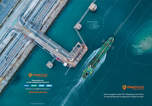
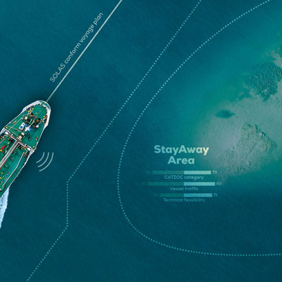
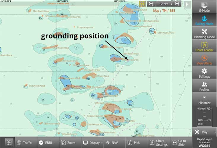
The new StayAway Areas from ChartWorld give mariners a more complete perspective.
CIO+ StayAway Areas
Make navigation safer from a new perspective
Making hidden shoals, derived from satellite images, visible
Covering areas with CATZOC worse than A2
Available for the Philippines, Indonesia, Caribbean Sea. More to come
Risk-mitigation tool for cases where your vessel needs to deviate from the main traffic lines
Delivered in real-time via the ChartWorld NavCloud service
ECDIS alarms will be triggered if vessels approach potentially unsafe areas
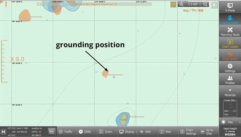
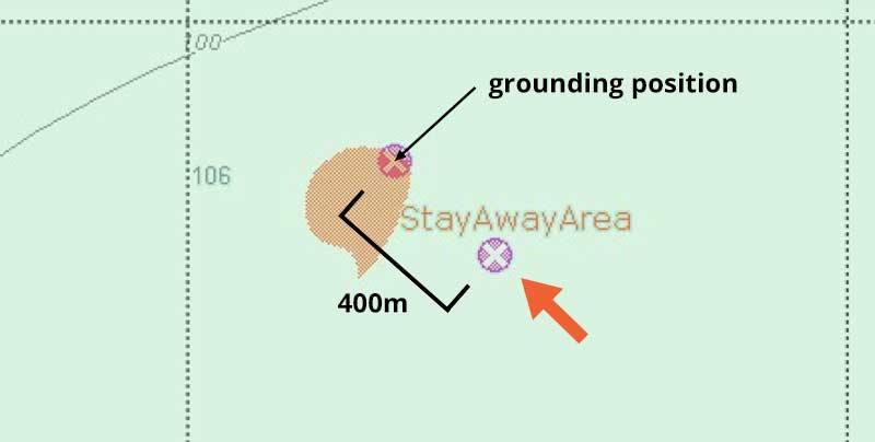
Evaluation of ChartWorld CIO+ STAY AWAY area data relevant to Various grounding cases (mentioned in Guard report; 07 JUL 2020, "Grounding incidents in the Indonesian archipelago" by Siddharth Mahajan)
Analysis of Grounding Locations vs. CIO+ StayAway
Results case by case - Analysis of Grounding Locations vs. CIO+ StayAway Area of interest: Indonesian Archipelago
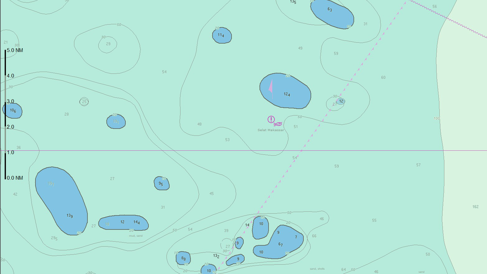
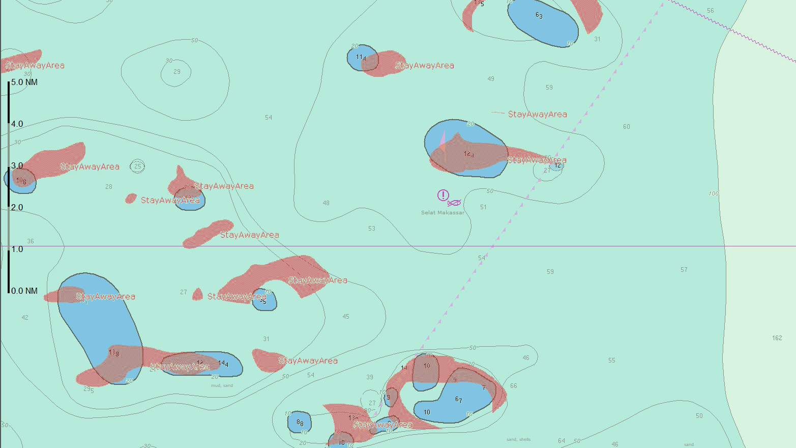
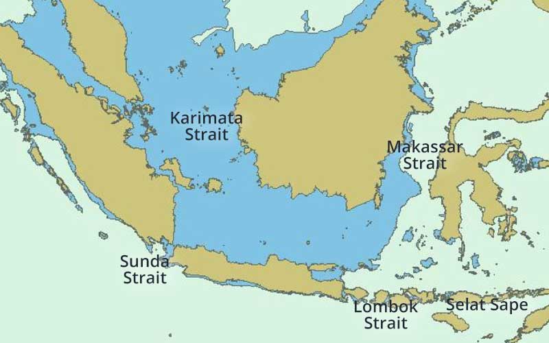
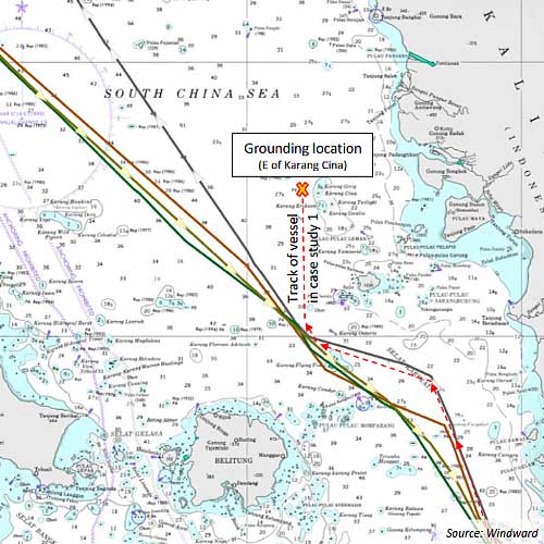
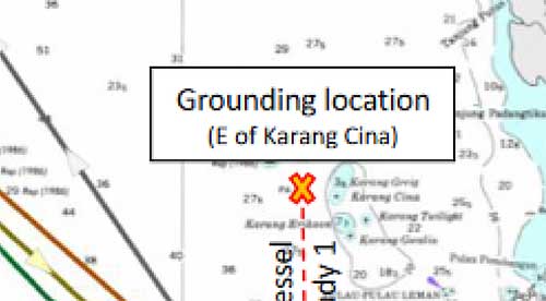
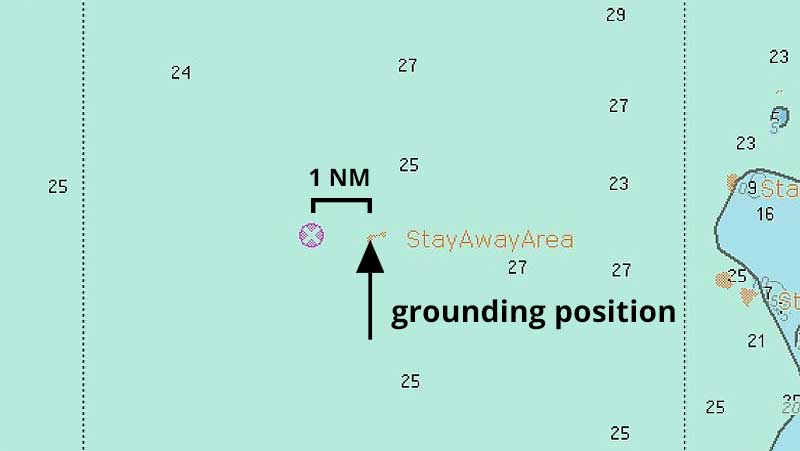
Case Study 1 - Grounding Karimata Strait
Year: Vessel: Bulk Carrier Draft: 13 m Voyage: Indonesia to Japan via Karimata Strait
CATZOC: C (±500m positional accuracy). No isolated danger at grounding position
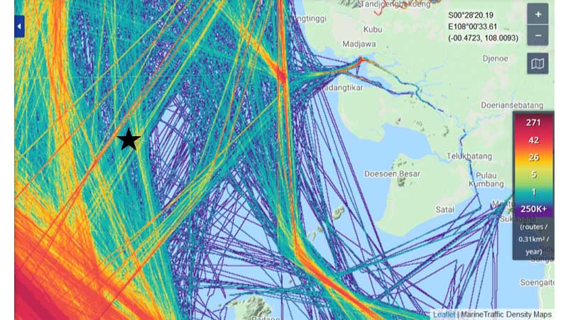
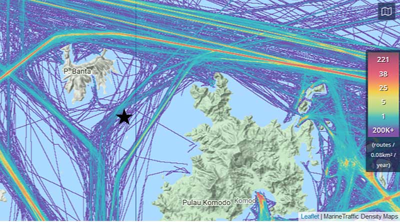
Traffic Density 2019 Map
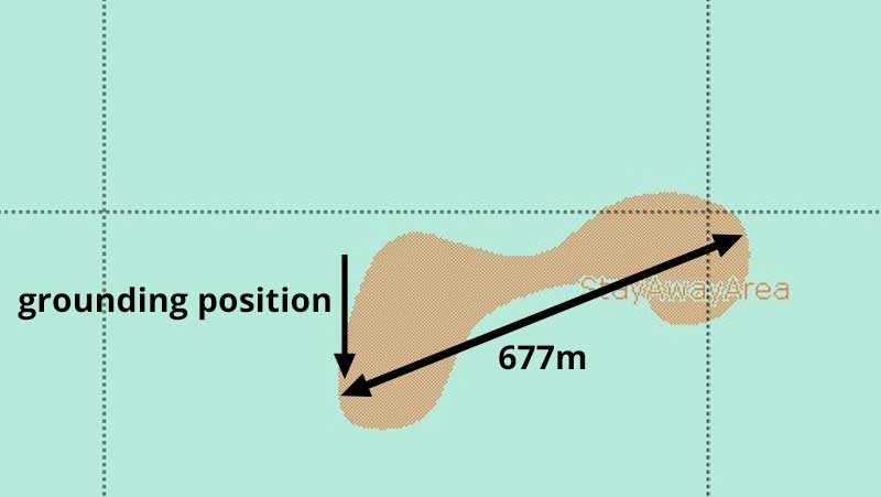
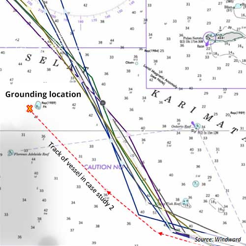
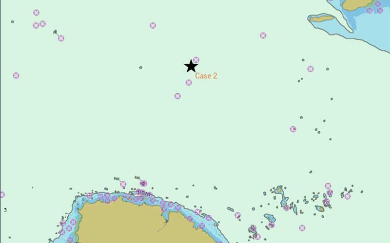
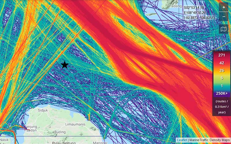
Case Study 2 - Grounding Karimata Strait
Year: Vessel: Very Large Crude Carrier Draft: 20 m Voyage: US Gulf to Japan via Sunda Strait - Karimata Strait
CATZOC: B (±50m positional accuracy) No isolated danger at grounding position
Traffic Density 2019 Map
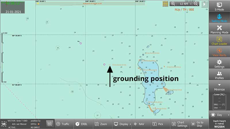
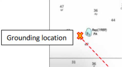
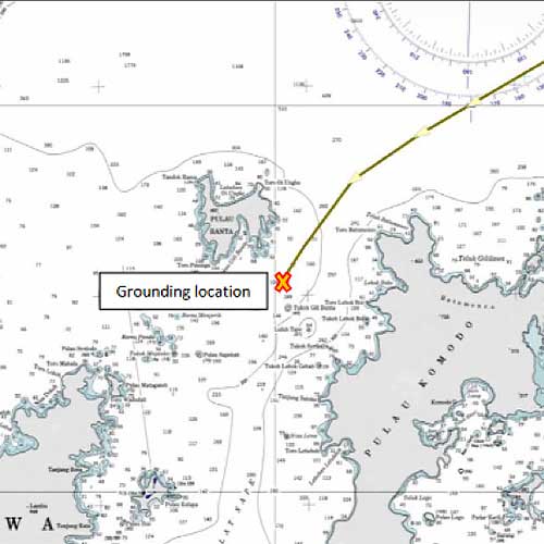
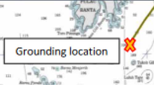
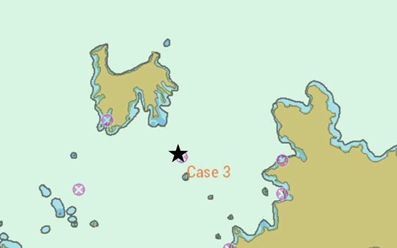
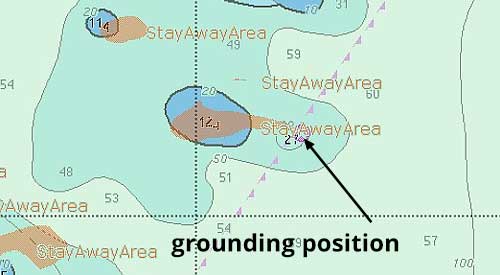
Case Study 3 - Grounding off Selat Sape
Year: 2018 Vessel: LPG Tanker Draft: 8 m Voyage: Indonesia to Australia via Selat Sape
CATZOC: C (±500m positional accuracy) Prior to the incident, the ENC showed one rock only (orange arrow). The second rock was inserted at the grounding position after the accident.
Traffic Density 2019 Map
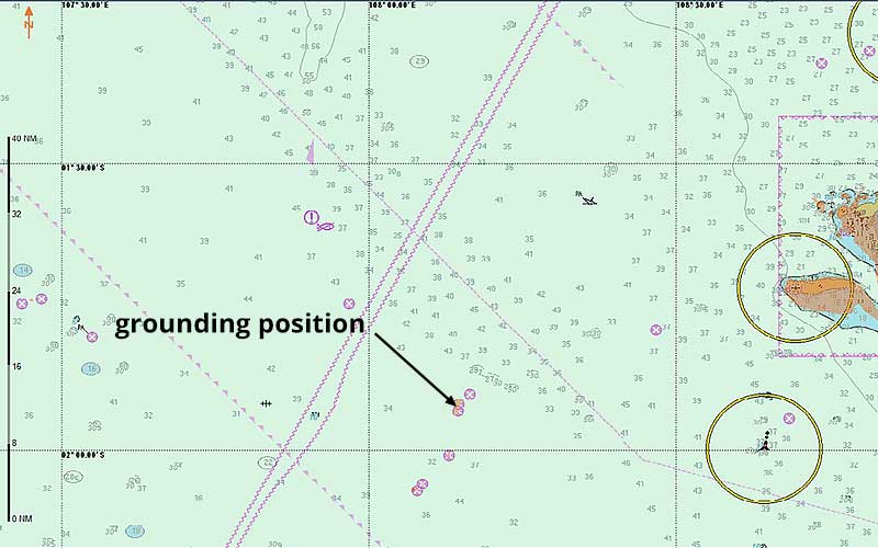
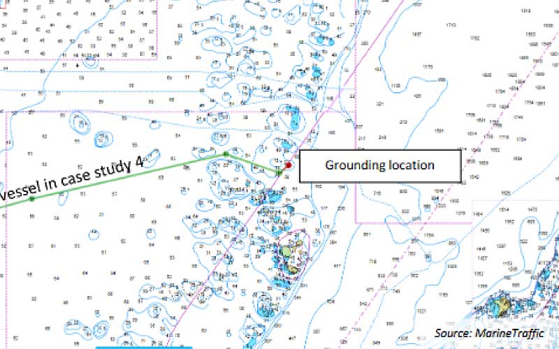
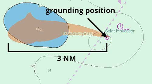
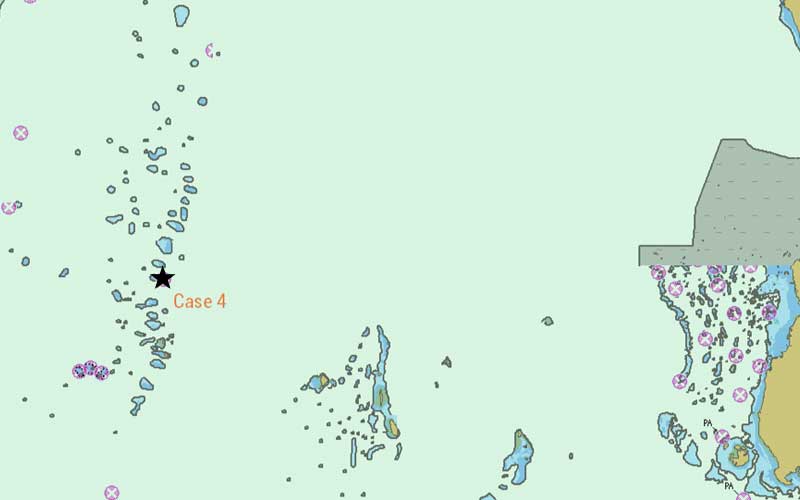
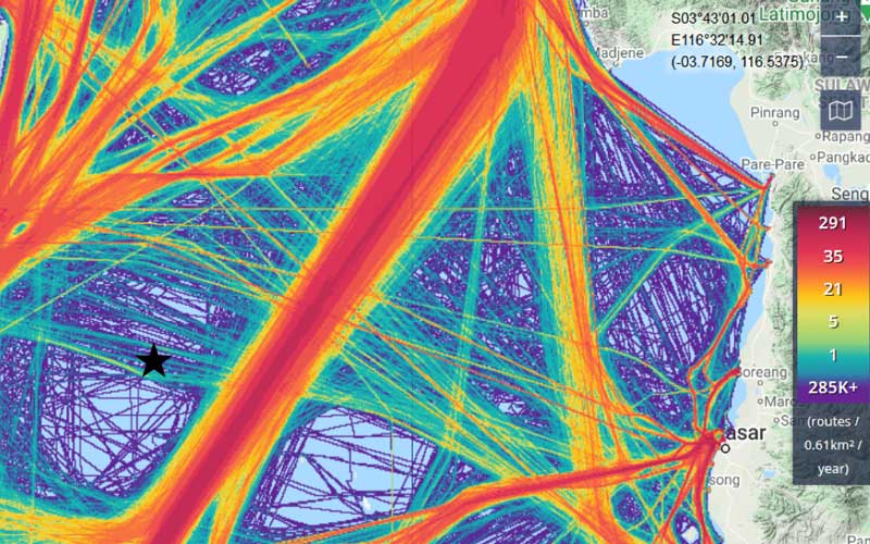
Case Study 4 - Grounding Makassar Strait
Year: Vessel: Bulk Carrier Draft: 14.3 m Voyage: Tobonao, Indonesia to South Korea
CATZOC: C (±500m positional accuracy) Isolated danger inserted at grounding position (apparently after accident).
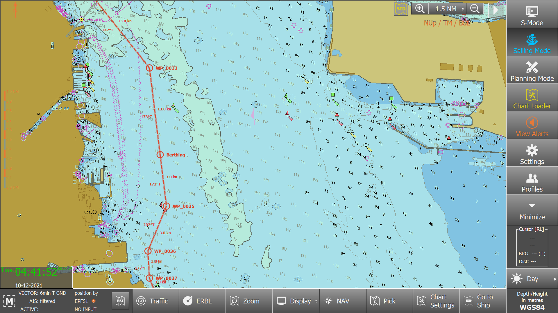
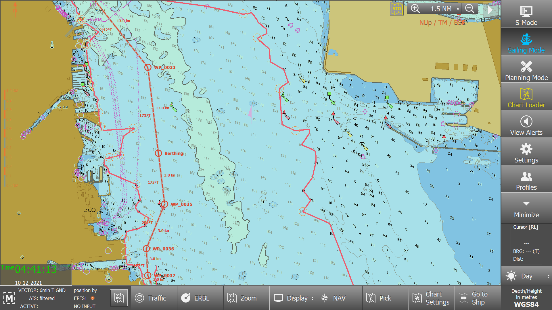
The service dynamically creates an additional demarcation line that is drawn on top of the ECDIS ENC (User Chart).
This line is drawn on both sides of the route and it is used as an additional reference when a vessel has to find its way through waters "behind" the safety contour, which are still considered as safe. In this respect, the NoGo line demarcates regions that must not be entered (i.e., NoGo) at all.
To process NoGo data, the service in the ChartWorld BackOffice takes the route information and the safety contour settings of the vessel. Then NoGo Areas are derived from those spot soundings and underwater obstructions (wrecks, rocks, obstructions) that have a depth value that is equal to or is less than the ECDIS safety depth.
The NoGo features are sensitive to ECDIS alert functions. Moreover, the service recognizes the need for an additional margin of safety, through the use of CATZOC. This guarantees that inaccuracies – which are inherent to all charts - are taken into account.
The regular CIO+ distribution processes take care of delivery of the CIO+NoGo Areas to the vessels.
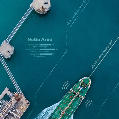
CIO+ NoGo Areas
Automated outline of dangerous areas for the voyage
Comply with OCIMF, Rightship and PSC requirement
Reduce the workload of the navigational officer
It is a risk-mitigation tool that NoGo areas are entered in the ECDIS and in use
Using official ENC data in a combination of ECDIS functions, to improve the safety of approaches
Automated NoGo lines, based on the safety-contour values of the ECDIS voyage plan
Real-time data supply as part of the NavCloud service
Please use the slider element to discover automated outline of dangerous areas for the voyage
Podcast
CIO+ NoGo Lines - ChartWorld International
Radio ECDIS, Date 2023/7/7
Radio ECDIS, Date 2023/7/7
00:00
T&P Notices to Mariners and NAVAREA Warnings
CIO+ T&P Notices to Mariners and NAVAREA warnings combine global UKHO T&Ps, local T&P NtMs, and NAVAREA warnings, in providing a comprehensive and enhanced update service for vessels navigating worldwide.
CIO+ T&P Notices and NAVAREA Warnings
Automatically plots T&P notices on your ECDIS
CIO+ is updated weekly or on-demand, to include, in a User Chart, all T&Ps for the intended voyage.
ECDIS user chart formats supported: eGlobe G2, Furuno FMD, Wärtsila NS4000, Tokyo Keiki ECDIS, and JRC ECDIS 9201/7201
Includes T&P NtM published by UKHO and Hydrographic Offices of China, India, and Colombia, where not already included in ENCs
CIO+ NAVAREA data for the whole voyage, not only within the range of NAVTEX or VHF
CIO+ NAVAREA is suitable for voyage planning and complements NAVTEX and radio warnings' services during execution of the voyage.
CIO+ Environmental is designed to help ships to comply with MARPOL and other environmental regulations.
The CIO+ Environmental is delivered as a user chart; along your planned route, it indicates intersections with special areas defined in the IMO MARPOL Convention, as well as in other national and international environmental regulations.
CIO+ ENVIRONMENTAL
Special areas taken into consideration by the CIO+ Environmental: MARPOL Annex I – Oil, MARPOL Annex II Noxious Liquid Substances, MARPOL Annex IV. Sewage, MARPOL Annex V. Garbage, MARPOL Annex VI, Emission Control Areas (ECAs), Special areas defined in China ECA regulations, Port ECAs defined by EU Sulphur Directive 2005/33/EC
Limits of MARPOL and ECA areas are defined from national baselines.
ECDISindicates the planned route's entry into, or exit from, areas with environmental restrictions. ECDIS alarms in route-planning and route-monitoring modes when approaching special areas. Area boundaries intersecting the route are prominently displayed in ECDIS.
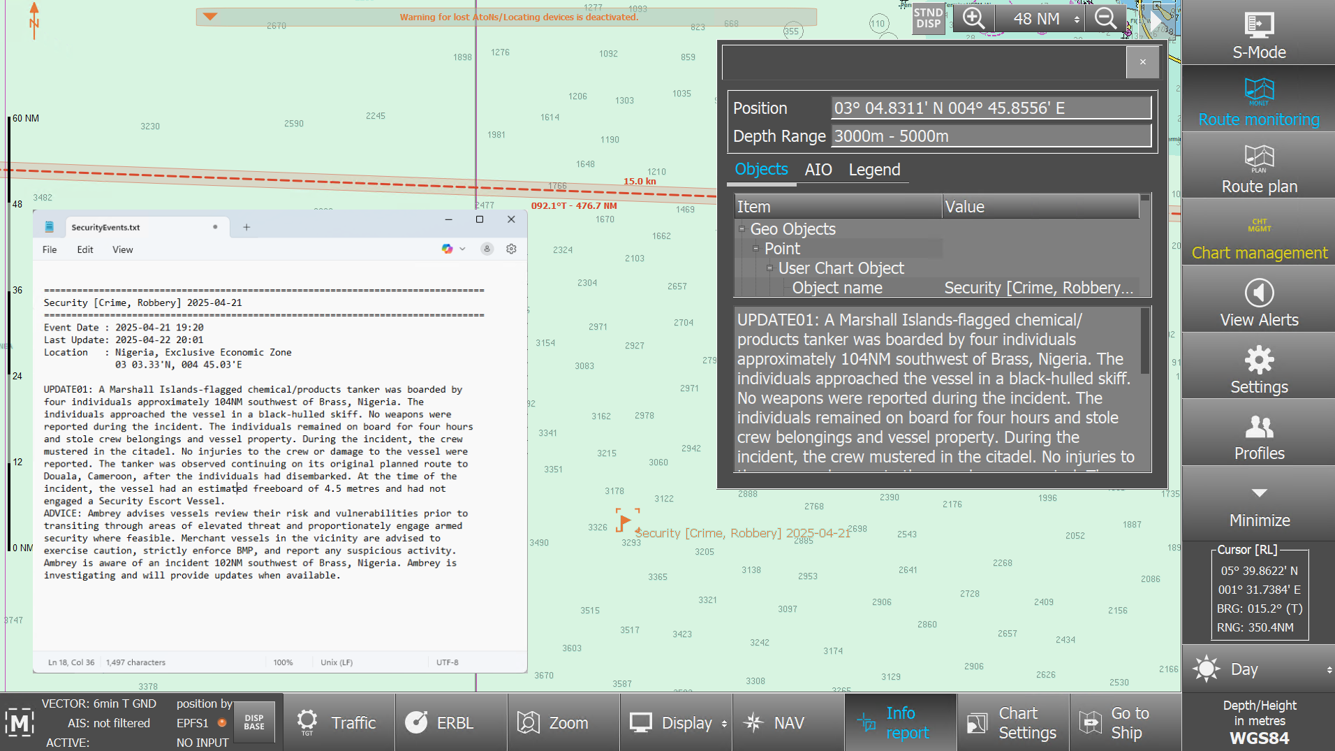
CIO+ Security provides real-time, vessel-specific risk alerts to shipmasters directly overlaid on the ship’s ECDIS. The service provides actionable geo-referenced intelligence on threats such as piracy, drone attacks and regional instability.
By informing crews and operators of potential threats along their routes, CIO+ Security improves maritime safety without constant monitoring.
CIO+ Security Benefits
Enhance safety and decision making along your route plan and avoid potential threats
Streamline your bridge workflows with real-time vessel specific risk alerts and route specific alerts directly on the ship’s ECDIS
Receive daily Security Alerts automatically via the ChartWorld eSync, ChartWorld MyRA service or via email
Powered by Ambrey, a leader in maritime security and risk management
Ambrey compiles comprehensive security intelligence and community insights gathered from over a thousand vessels daily.
CIO+ Security in Action
Geo-referenced chart objects pinpointing exact locations of reported incidents, enabling users to monitor these directly on the ECDIS. In addition to geo-referenced alerts, we offer a supporting document, giving a comprehensive overview of all relevant security alerts along the route.
CIO+ Security Compatible ECDIS Systems
ChartWorld eGlobe G2
Furuno
JRC JAN 9201
Tokyo Keiki
Wartsila NS 4000
Ready to learn how ChartWorld and CIO+ Security can help you make informed decisions? Get in touch and speak with ChartWorld digital navigation expert